Tuesday, 28 May 2013

A Volatile Moon


Last week, I attended the NASALunar Science Institute's Workshop without Walls on Lunar Volatiles. The really interesting thing about this workshop is that it was conducted completely on line. Presenters gave their talks using a web cam, and they and their slides were displayed in a split screen through a regular web browser. This meant the talks could be followed by anyone with a computer and internet access. I watched from home, but some people gathered in designated meeting hubs, to get more of a communal experience. Participants could also interact with the speakers or other participants through chat windows.  The best part of this kind of virtual workshop, is that all the talks were archived and are now available through the site's Schedule web page.  I would encourage you to go check it out!
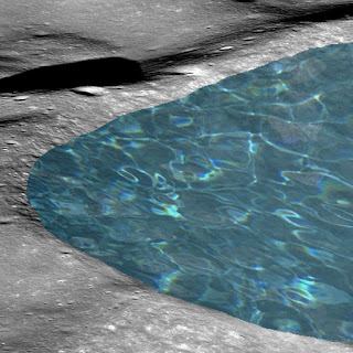
Fictitious Moon Lake
There is a lot of water on the Moon, but not this much!
Image Credit: NASA/GSFC/Arizona State University and Irene Antonenko
In the very first talk of the workshop, Dr. Larry  Taylor from the University of Tennessee summed up the exciting turn-around that has happened in the study of lunar volatiles over the past few years.  Up until relatively recently, we thought the Moon was "bone dry", but now we know it is quite "wet" in a variety of ways.

Back in the Apollo era, the accepted wisdom was that the Moon contained effectively no water or other major volatiles, not only on the surface, but in the rocks themselves too. It was believed that all the volatiles would have evapourated during the Moon's very hot formation and any volatiles added later on wouldn't have stayed on the surface very long - volatiles being relatively light would have easily escaped the pull of the Moon's weak gravity. So, the Moon must be very dry.

This belief was so entrenched in the 1970's that when rust was found in samples brought back by the Apollo  missions, it was determined that water from the Earth must have contaminated the sample boxes and allowed the iron-rich lunar materials to rust.  Dr. Taylor himself pleads guilty to pushing this interpretation and confesses that "his big mouth" convinced people that this was just terrestrial contamination.

Moon Mineralogy Mapper Water Data
This data from Chandrayaan-1's Moon Mineralogy Mapper instrument shows the distribution of various materials on the Moon. Small amounts of water and OH molecules show up as blue, and are clearly concentrated at the poles, where low temperatures are more likely to trap them.
For more information on this image, check out the Moon Mineralogy Mapper Exploration Resources page.
 Image Credit: NASA/ISRO/Brown Univ.
However, in 2009 it was finally realized that there was water on the Moon, when data from the Clementine, Lunar Prospector, and Chandrayaan-1 orbital missions all showed evidence for its presence.  With so much data pointing to water on the Moon, the reality could no longer be ignored.  Dr. Taylor himself admits that he has completely changed his position on the topic!

With all this orbital evidence for water, a number of researchers took another look at the Apollo lunar samples. Analyzing basalt rocks with techniques that were not available in the 70's, they found a significant amount of water within the minerals that make up the rocks, in some cases as much as 1% of sampled minerals.  

The important thing about basalt is that it is solidified magma. As such, basalts provide a sample of the lunar interior, from where the magma originates. So, the presence of water in the basalt rocks means that there must have been water in the lunar interior at the time these basalts formed on the Moon's surface.
Thin Section of Apollo Basalt 14053 in Cross Polarized Light
A thin slice of Apollo basalt sample 14053 viewed magnified in cross-polarized light (xpl). Each type of mineral interacts differently with the polarized light, producing the various colours we see.
You can explore this thin section for yourself at The Open University-NASA Virtual Microscope.
Image Credit: NASA/Open Univ.
So, the questions now is, where did this water originally come from? If the Moon formed when a Mars-sized object crashed into the early Earth, the ejected debris that formed the Moon really would have lost all its volatiles to space. One theory is that comets that impacted into the Moon very early in its history could have delivered enough water to seed the interior with the needed volatiles. The problem, however, is that analyses of lunar water show that it is more similar to asteroid and terrestrial water than water from comets.  So, the water we see could not have come from comets.

We know that currently water on the surface is being replenished by impacts and solar wind. Even small hypervelocity (~2-20 meters per second) impacts can crush atomic molecules, breaking them up and leaving "dangling bonds" of oxygen (oxygen is a major component of all rocks, and so is very plentiful). Hydrogen from the solar wind then bonds to these available oxygen atoms, creating water. However, this process works only on the surface, and can't account for water deep in the lunar interior.

At the moment, we have no idea how water from the Earth and asteroids got into the Moon's interior. A lot of work still needs to be done to understand this aspect. But, the field is hopping, with lots of renewed interest in a topic that was, until recently, thought to be impossible.  Stay tuned....

Source:
Taylor L., 2013, Where and in what physical form do volatiles exist: Perspective from sample analysis? NLSI Workshop without Walls - Lunar Volatiles, May 2012. AbstractTalk.

Tuesday, 14 May 2013

Flowing Mercury

This month's Planetary Geomorphology Working Group Image of the Month focuses on volcanic flow channels on Mercury. Check it out. The images and write up there inspired me to look more deeply into these interesting features.

Scientists have long suspected that Mercury had a volcanically active past, ever since the Mariner 10 flyby in 1975 found large smooth plains areas on the planet. These suspicions were confirmed more recently by the MErcury Surface, Space Environment, GEochemistry and Ranging (MESSENGER) mission. MESSENGER compositional data suggest that much of Mercury's crust consists of volcanic rocks.

Mercury Northern Plains in Enhanced Colour
The northern smooth plains of Mercury, as imaged by the imaging system on the MESSENGER mission, with the colour enhanced to show off differences in composition.
Image Credit: NASA/ JHU - APL/Carnegie Inst. of Washington

The problem is that these plains are rather dull as far as volcanic features go, at least when compared to other planets. The Mercury plains are vast flat areas with very few distinctive features. No spectacular volcanic edifices, like we see on other planets. Even vents that represent the source of the lava are not generally found.

That's why scientists were so excited to find some interesting volcanic features in the high northern latitudes of Mercury a few years ago. These features showed quite clearly that large quantities of lava had flowed in torrents across the surface of Mercury in the past.

Dr. Paul Byrne from the Carnegie Institution of Washington, working with colleagues on the MESSENGER science team, identified a number of channels at the edges of the vast smooth plains in the northern parts of Mercury. Some of the channels are broad and straight, while others are narrow and sinuous, winding through the rugged terrain, though all of the channels appear to have served as conduits for hot lava flows. As such, the floors of the channels tend to be smooth and often contain kipukas, which are elevated islands surrounded by lava flows. The kipukas here seem to represent the remnants of ancient impacts, most likely uplifted central peaks of craters, their rims, or even rubbley ejecta, all of which have been flooded by more recent volcanic materials. Some of the kipukas also show signs of having been sculpted by the lava flows that rushed past them; their shapes are streamlined and elongated parallel to the sides of their channels.

Using images from the Mercury Dual Imaging System (MDIS) cameras on board the MESSENGER spacecraft, Dr. Byrne and his colleagues have now studied these channels in greater detail. The channels mostly connect different degraded impact basins together. These basins (which are bigger than 100 km in diameter) seem to have been flooded by lavas, which then breeched the perimeters of the basins and proceeded to further erode and widen existing gaps, often causing entire portions of the weakened basin rim to fail.

Mercury Volcanic Channels
Flat-floored channels near the northern smooth plains of Mercury, contain streamlined islands that appear to have been sculpted by hot lava as it flowed around them.
Image Credit: NASA/ JHU - APL/Carnegie Inst. of Washington
The problem is that it is not always easy to tell which basins were the source of all this magma, and which merely acted as a bowl to catch the lava flows. The source vents, from which the lava poured out of the ground, tend to be buried under the solidified lava, and so are difficult to find. Flow features, which could be used to tell which direction the lava flowed, are also missing. On Mars, channels made by catastrophic flooding from large amounts of water have formed tear-drop shaped islands, which show which way the water flowed (in the direction the sharp end of the tear-drop points). But the kipukas in Mercury's channels are not tear-drop shaped. Some channels contain a spray-like pattern of kipukas at one end of the channel and it is assumed that these represent the "mouth" end , where the lava flowed out of the channel. When no such clues were available, Dr. Byrne and his team used elevation data from MESSENGER's Mercury Laser Altimeter instrument to determine which direction was down slope and so most likely to represent the way the lavas flowed.

This kind of information, along with studies of other surface features, was used to determine how fast the lava would have flowed and filled up the downstream basins. For the lava not to cool before it could reach the end basin, it had to have been very hot and very runny. Also, there must have been lots of it. Dr. Byrne and his colleagues estimate that under such conditions, basins of the size seen in this region would have been filled up within a matter of 2 weeks to a month. Furthermore, such large quantities of hot lava would have actually been able to melt these channels into the surface. In other words, these channels have been carved out of the existing rugged terrain by hot, runny lava, much like hot wax can carve out channels in cold older wax!

So, the question then is, why don't we see more of these kinds of features throughout the plains areas of Mercury? The current thinking is that the channels that we do see represent the "last gasp" of volcanism on Mercury. Dr. Byrne's flow studies suggest that the lavas here may have originated from the vast volcanic plains in Mercury's northern areas. It is thought that the northern plains would have originally contained numerous such flow channels, which were then flooded by large quantities of lava that now make up the huge flat plains. Towards the edges of the plains, however, flow channels would have been left behind as the magma supply ran out before the channels could be covered up.

The most interesting thing about these channels is how much they resemble outflow channels on Mars, which are thought to have been formed by catastrophic floods of water. In fact, such channels are often used as evidence for a watery Martian past. However, liquid water is not stable at the temperatures and pressures found on the surface of Mercury, so the features on Mercury can't have been formed by water. They must have been formed by volcanic processes. And, if they can be formed by volcanic processes on Mercury, perhaps they can also be formed this way on Mars. Maybe water is not needed to explain the existence of such land forms anywhere. It's an intriguing thought and means we really need to go back and take a more careful look at these features on Mars.

You can explore channels and other features on Mercury for yourself at the ACT-REACT QuickMap online MESSENGER image tool. To go directly to the study area discussed above, click HERE.

Source: Byrne et al., 2013, An assemblage of lava flow features on Mercury, JGR, DOI: 10.1002/jgre.20052.